Early in the calendar year is map design season around TeleGeography. Colorful proofs arrive at the office, which the design team pores over, so as not to miss any details. No cable left behind. No design flourish left unexamined.
So when the DC office packed up and transitioned to remote work in March 2020, we were left to wonder: how were we going to finish our cable map from within quarantine?
Making Maps in an Era of COVID
Head Designer and Cartographer Larry Lairson and Vice President of Systems and Design Markus Krisetya were already used to working with a semi-remote team, giving them the ability to quickly continue work on the design without much interruption.
There would be no huddling over a shared monitor to oversee edits, no leaning over our map table together to talk over the latest round of changes. And there would definitely be no press check—a trip to visit our printers in Milwaukee to assess the design as it comes off the press.
But there would be no huddling over a shared monitor to oversee edits, no leaning over our map table together to talk over the latest round of changes. And there would definitely be no press check—the annual trip to visit our printers in Milwaukee to assess the design as it comes off the press.
"With the pandemic, the biggest change on the production side is, for the first time, we did not attend the press check in-person," said Krisetya. "We were lucky to have our chain of suppliers still operational with social distancing in effect at their plants."
Physical Maps, Virtual Times
As socially-distanced map design churned along, there was another major hitch. The events at which we distribute the map were falling like dominoes, many going remote or cancelling altogether.
As socially-distanced map design churned along, there was another major hitch. The events at which we distribute the map were falling like dominoes, many going remote or cancelling altogether.
The big one was ITW, a major distribution channel for our map sponsor.
The solution? Do as the conferences do and go virtual.
"We pivoted to a more immersive interactive map website that includes a story-telling feature and linked sites and data, as well as downloadable printable maps" explained Krisetya.
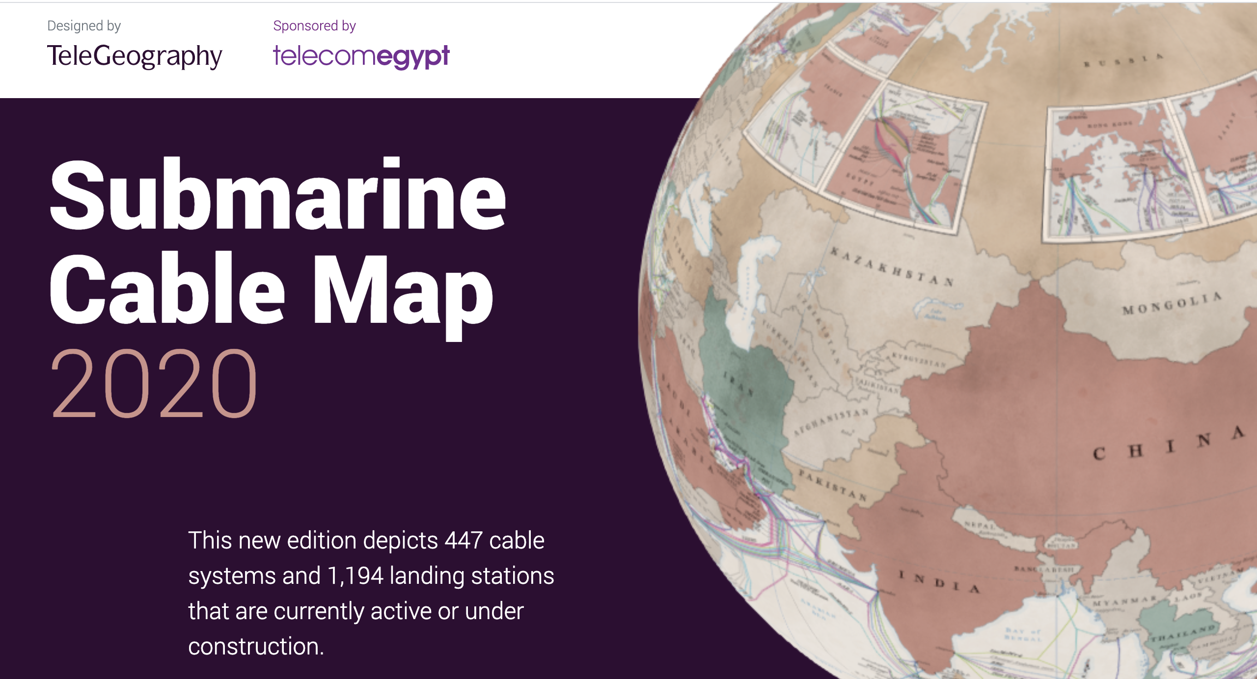 The 2020 Submarine Cable Map, made into a special interactive feature.
About the 2020 Design: Why Make an Antique Cable Map?
By the time the TeleGeography team sorted out how to finish the 2020 edition in quarantine, major design decisions had already been made. The team was full steam ahead on an antique approach.
And this isn't the first time we've gone antique for our annual design. After the highly popular, vintage 1920s submarine cable map we released in 2013, we did our medieval, turn-of-the-century 2015 sea monster map.
Why are these maps so popular?
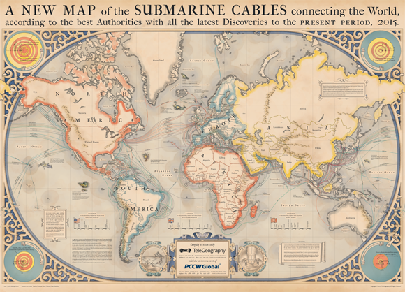 The famous 2015 sea monsters design.
Markus has a theory. "The juxtaposition of the modern with the old is at the core of the appeal. Modern maps focus on functionality and clarity. Antique maps provided cartographers of their time the liberty of adding flair and design details that serve as another layer of visual interest," he said. "By making our cable map antique we give the content a new reference point that is of particular interest to map nerds and can be appreciated by the general public as a work of art because we do not sacrifice the clarity and data behind the map."
The 2020 Submarine Cable Map is officially available for purchase and will begin shipping in July.