It's a great day to be a submarine cable fan.
Why, you ask? Because the latest and greatest TeleGeography Submarine Cable map is now available.
The 2018 edition, which is sponsored by Telecom Egypt, depicts 366 cable systems and 1,006 landing stations that are currently active, under construction, or expected to be fully-funded by the end of 2020.
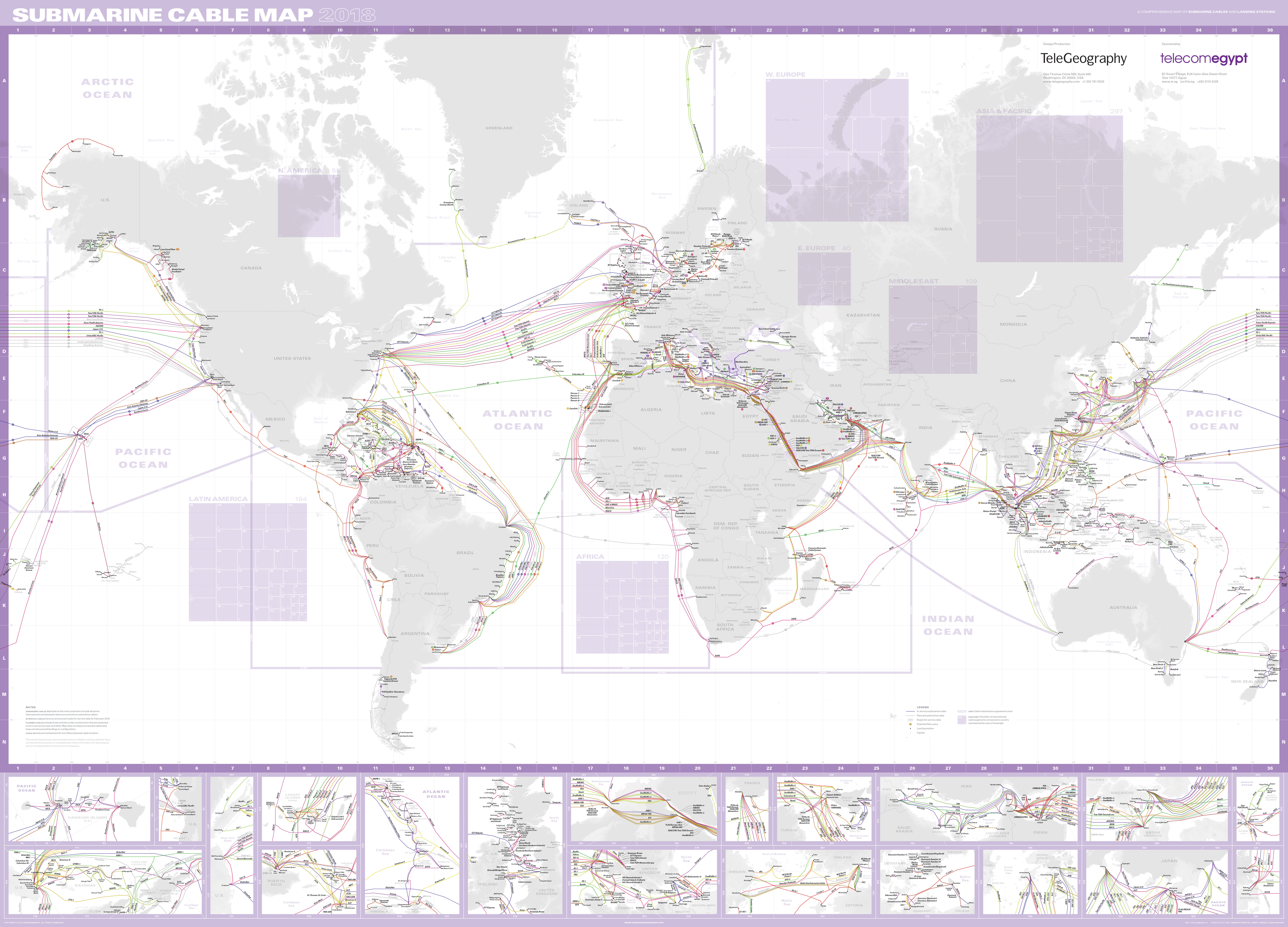
The 2018 map was designed with an extreme utilitarian approach to provide the first global submarine cable map we've produced that focuses entirely on where cables traverse and connect to landing stations.
In this edition you'll find more magnified detail than we've ever presented before. Our team consulted industry insiders on what the most practical submarine cable map would look like. This is it.
The 2018 map also presents metrics for:
- Number of potential fiber pairs on select cables
- Cable maintenance agreement zones
- Treemaps depicting resiliency, the number of international segments connected to each country and region
- Detailed views of 20 dense areas including the Caribbean, Singapore, the Persian Gulf, and more
To learn more or place an order, click here.
We would like to thank our generous sponsor Telecom Egypt for making this map possible.